The Watchtower of Obong, Dalaguete
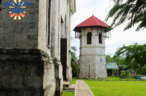
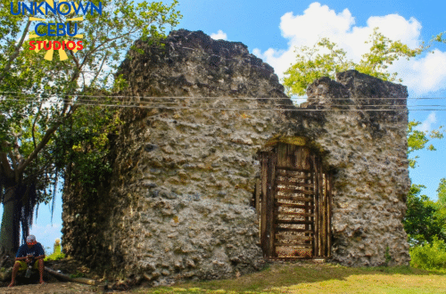
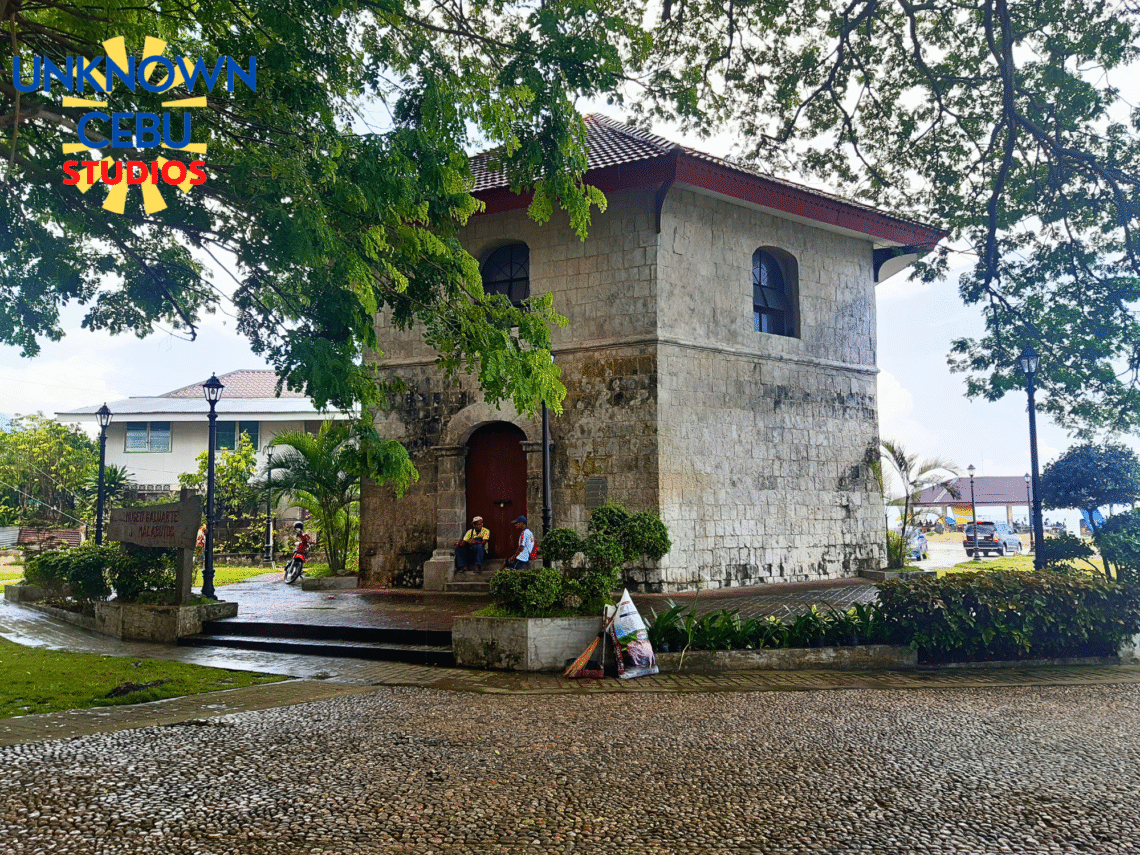
Part of UnknownCebu’s Dalaguete trek is one which we have made before: the Baluarte at Obong. Once, there was fear in the south of Cebu...

Revealing the History and Heritage of the Philippines: One Post at a Time
Discover top trending posts from our blog.
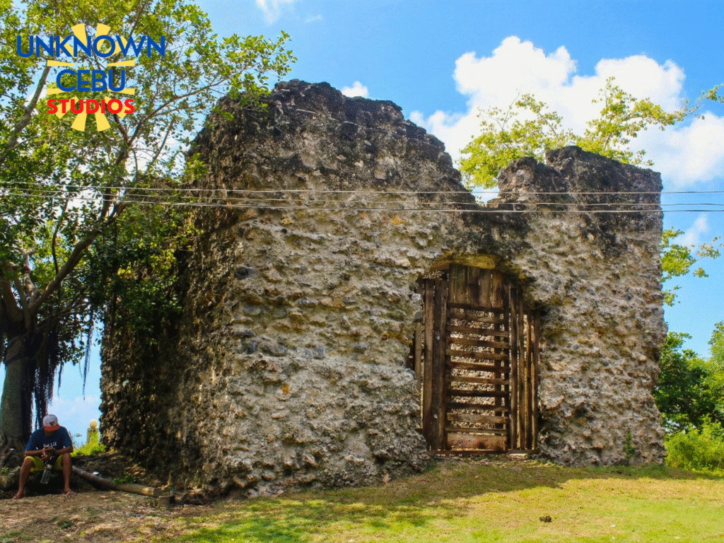
Part of UnknownCebu’s Dalaguete trek is one which we have made before: the Baluarte at Obong. Once, there was fear in the south of Cebu...
If you have ever driven down the southern arterial road of Cebu, past the bustling...

There is a distinct shift in the air when you travel down the southeastern flank...

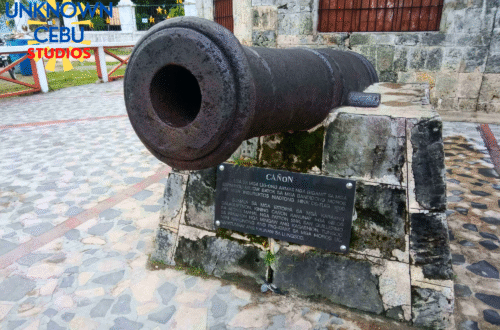
When you stand on the seawall of Dalaguete today, looking out over the calm, azure...

Part of UnknownCebu’s Dalaguete trek is one which we have made before: the Baluarte at Obong. Once, there was fear in the south of Cebu due to pirate raids, that fear is embodied in the ruins of the Obong Watchtower, a structure that sits stoically beside the famous cold spring.…

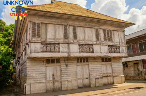
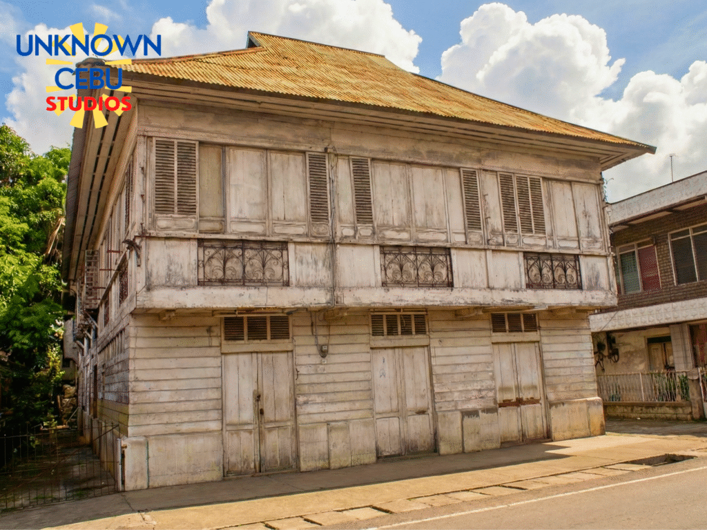
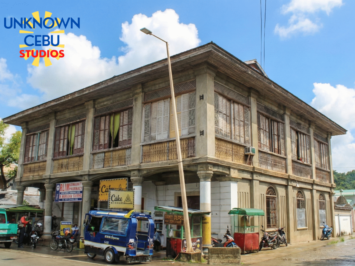
If you have ever driven down the southern arterial road of Cebu, past the bustling public market of Dalaguete and near the river that slices through the town, you have likely turned your head at a structure that refuses to be ignored. It is the Conrada Almagro Ancestral House; locals…
There is a distinct shift in the air when you travel down the southeastern flank of Cebu, past the bustling city and into the quieter, salt-sprayed towns facing the Bohol Sea. We often think of Dalaguete solely as the “Vegetable Basket of Cebu,” a place of high peaks and cool…
When you stand on the seawall of Dalaguete today, looking out over the calm, azure waters of the Bohol Sea, it is almost impossible to imagine that this horizon was once the source of absolute terror. We know Dalaguete now as the “Vegetable Basket of Cebu,” a peaceful town of…
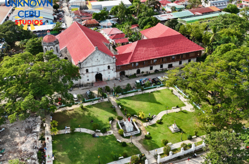
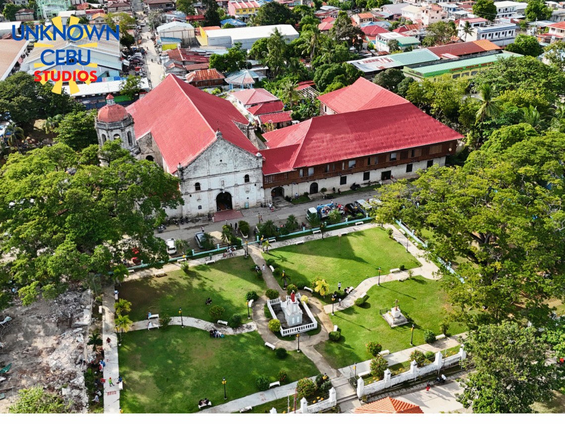
The southwestern coast of Cebu’s churches are arguably less studied and less well-known in comparison to those from the east coast of Cebu. Though somewhat off the beaten path today as well as the many years of yesteryear, heritage structures still dot the landscape. Among these heritage structures, the San…
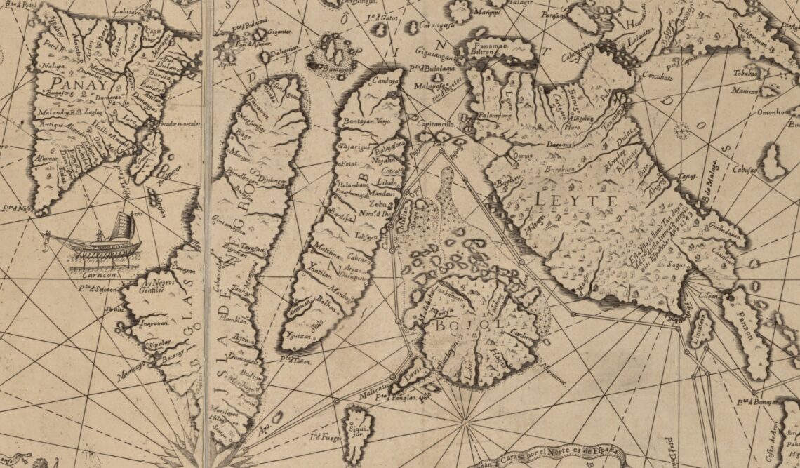
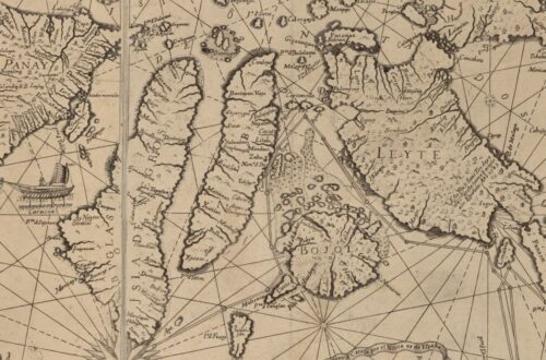
The Carta Hydrographica y Chorographica de las Yslas Filipinas, commonly known as the 1734 Murillo Velarde Map, is often cited as the “Mother of all Philippine Maps.” Looking specifically at the segment depicting the island of Cebu (labeled “Zebu”), one is immediately struck by how recognizable the geography and toponymy…
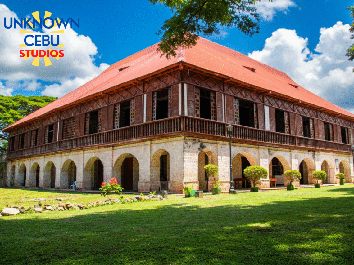
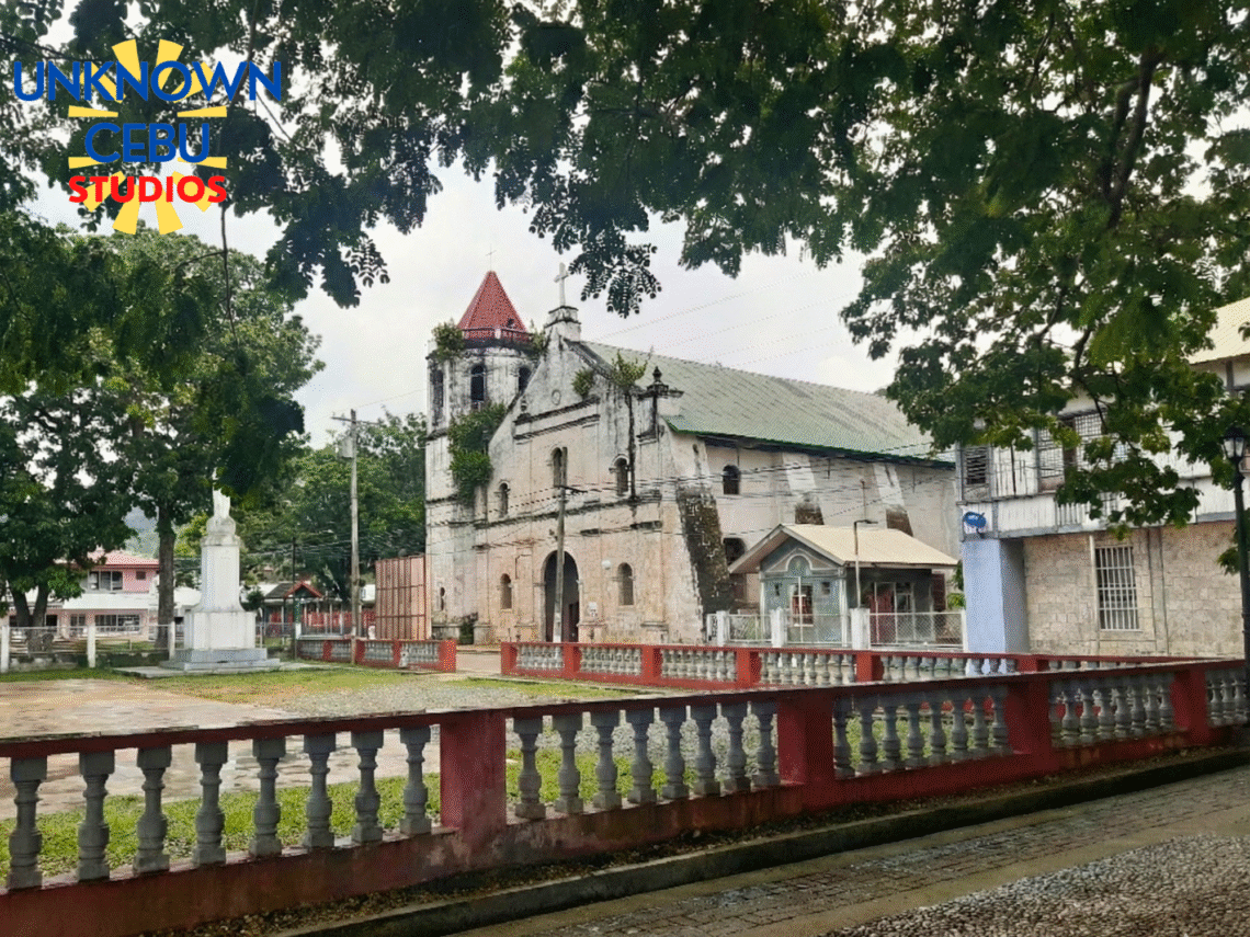
Stepping into the town of Lazi on the southern edge of Siquijor, one is immediately arrested by a sense of scale that seems almost out of place in such a tranquil, provincial setting. Here, amidst the whispering acacia trees and the humid breeze of the Mindanao Sea, stands the San…
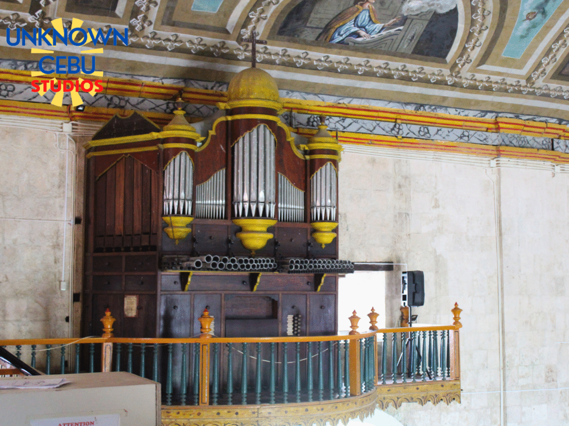
In the quiet coastal town of Valencia, Bohol, formerly known as Panangatan, the architectural timeline of the Philippines is often measured in the erosion of coral stone or the fading of timber. Yet, dominating the town center stands a structure that defies the organic decay of the Spanish era, asserting…
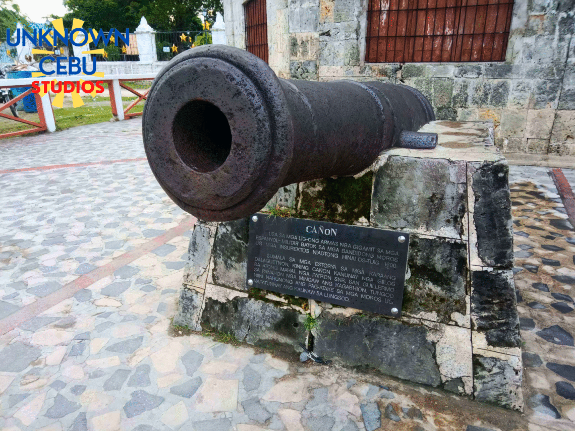
The southern littoral of Cebu possesses a deceptive tranquility, particularly along the Tañon Strait in Malabuyoc. Observing the silhouette of Negros Island across the channel, one might appreciate the scenic geography, yet a historical analysis reveals this strait was less a picturesque boundary and more a strategic chokepoint. The calm,…
There is a specific quality to the air in Loay, where the mouth of the Loboc River spills into the Bohol Sea, a mix of brine and the ancient humidity of the river delta. It was here, upon a plateau chosen for defense against the slave-raiding fleets of the past,…